Showing posts with label railroad. Show all posts

Saturday, September 11, 2021

Galatea, Colorao


Galatea, Colorado


Galatea was a Railroad town established by the Missouri Pacific railroad as it built west.  As the railroad moved across southern Colorado, they began naming their stops in alphabetical order.  And the G stop was named Galatea. 


Like many of the RR stops, Galatea faded into memory.  A few building still stand on the former town site, along with some trees.   Out along the tracks are a few pieces of concrete where the depot, etc had been. 


Couple miles NE is the town cemetery and there are a few headstones among the overgrown weeds. 


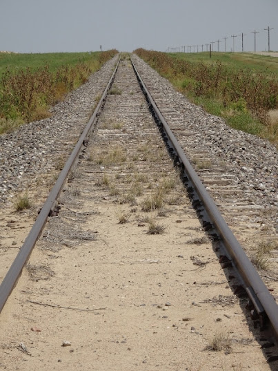
Galatea is located in a dry harsh area and is not easy to eke out a living.  There are still a few souls that live in the area scratching a living from the dirt.  Yet the dirt blows real easy here and in spots are the drifts of blow dirt.  The rails had been silent for years, with a new owner, the iron wheels clatter over the rails again. 


The Missouri Pacific was not the first RR to go through the area.  In the 1870’s, the Kansas Pacific built a branch line through here on their way to Ft Lyon and the Pacific Ocean. 


The Arkansas Valley Railroad was short lived.  About ten years later the rails were pulled when the KP went into receivership.  During that time, freight traffic from the Santa Fe Trail was being loaded on the AV RR and going East.  Besides freight trains, there was the daily passenger train, it was a busy RR. 


Today there is no indication that another railroad had been the area.  The old right of way has been plowed up for farming.  Further north, towards Kit Carson, portions of the grade can still be seen in the pastures. 


Today the silence of Galatea is ruffled by the breezes that flow over the land.  The greeting committee is either the owl or the buzzard. 


Sunday, July 19, 2020

Carlisle Colorado PO


Carlisle Colorado

Carlisle was a small country Post Office, in operation during the early 1900’s.  On the map it is shown to be less than a mile from the RR community of Peconic. 

Operated out of a private residence, this little Post Office served the railroad workers and the few homesteaders in the area.  With a short spyglass, one can watch the jayhawkers floating on the far horizon in Kansas.

The Chicago, Rock Island and Pacific RR built through this area in 1888.   The RR designated the stop Peconic, but not much happened there.  The Post Office was located nearby since there were no homes in Peconic.  A grain elevator was eventually built, still no homes showed up. 

Down the rails to the East was the Post Office and more than likely it was a RR section house.  Keeping the RR operating was a labor intensive and sections were close together to keep the rails maintained. 

Today where the map shows where Carlisle was located is a grove of evergreens surrounded to by ag equipment.  There is an AG dealer located at the Peconic siding and a variety of cars are spotted there.  The grain elevator sits dormant. 

The cars and trucks whiz by on the Interstate as life in the farmland moves on.  Carlisle is pretty well forgotten and but a dot on an old history map. 


Saturday, August 31, 2019

Transcontinental Silver Spike


The Great Train Race

               July 1870, the Kansas Pacific Railroad arrived at the Willow Springs stage station.  Rather than put their train stop at the stage stop, the RR went on west a bit and built a division point.  Here they would build a roundhouse and a depot.  This wide spot the railroad was building would become the village of Hugo, Colorado. 
               While the Kansas Pacific was working on their division point, their subsidiary, the Denver Pacific had arrived in Denver.  Completing the rails from Cheyenne to Denver.  Governor John Evans had run out of money and could not find any more financing  So the governor went to the KP and struck up a deal.  The KP would provide the financing and money to complete construction of the DP to Denver.  In return, the KP would gain controlling interest of the DP.


               So it was agreed that the newly constructed RR would become a joint line operation between the two railroads.  The newly formed town of Hugo came into existence.  The midway point between Hugo and Denver was Strasburg.  To this point the two railroads would race.  The winner getting bragging rights and all the puffery they want.
               So the race began, the Denver Pacific building East from Denver, the Kansas Pacific building West from Hugo.  The sweat rolled off the gangs as they laid rail.  Records were broken for the most rail laid in a day.  The men were leaning into their work, wanting to beat the other RR gang from that other RR. 
Work continued uninterrupted, most the Indians had left the area and Custer and his troops were still assigned to patrol the KP line.  The work crews were about a days’ work from the finish line and the roar of the workers rolled over the grassland.  Next day would the end of the race, the transcontinental RR would be completed.
               That night the KP foreman took some men and walked the ROW to the finish.  As the men walked along, they were making sure things were in order for the next day sprint.  Rails were lined up, spikes were placed, fish plates and bolts were at the joints to hook the rails.  If they found bad ties, they were replaced or corrected. 
               Next morning with first light, the workers were out laying rails.  The sing song of the workers serenaded pares life.  Apparently that little extra effort of the KP foreman worked.  For the KP crew arrived at Strasburg over an hour before the DP showed up.  When the DP got the last rail in place the celebration was underway.  Dignitaries were on hand and barrels of whiskey rolled on to town by the wagon load.


               The KP chief sought out the KP foreman to be caretaker of the Silver Spike for the ceremonial driving of the final spike, a Silver one.  The whiskey flowed and all night the crews celebrated.  Next morning the Dignitaries were busy getting ready and the KP chief was looking for his foreman. 
               The Forman was found, sleeping off the night before.  The chief asked him for the spike.  Picking up his pants and rifling through the pockets, the silver spike could not be found.  During the night’s celebration the Silver Spike had gained its freedom and gone on down yonder someplace. \
               Uttering choice words, the chief stormed off the ceremony without the treasured spike.  The foreman, still blurry and fuzzy staggered after him and produced a regular spike.  And the Transcontinental RR was completed without the driving of the silver spike. 
               Oh the KP had a bridge over the Missouri River.  The Union Pacific had to ferry their passengers over the waterway.  In a Strasburg town park is a small obelisk marking the Silver Spike Ceremony.  It will no rival Promontory Point for notoriety.  Instead it will be a splitter of hairs and maybe a footnote in history books. 


Friday, January 27, 2017

Golden Belt Route ..... Part III

Boyero
            Continuing along the Golden Belt Route, one travels over one of the old concrete bridges from the early 1900’s, crossing Coon Creek.  Bouncing over the country road, is bouncing along with the wagons that traveled next to the railroad tracks more than 100 years ago.  Very few vehicles roll along the road and fewer trains sing on the iron rails.  On the road to Boyero, the land is mostly unchanged, it is open range, cattle stand on the road looking at the interlopers, deer lounge in the shade of the few trees and birds serenade the traveler. 

            It is traveling back to another era, listen to the land as it sings.  Here one can gaze across the emptiness and hear the creak of the wagons, see the puffs of dust from the wheels.  It is now cattle that graze on the grasses, sharing with the wildlife.  The eagles feast on the prairie dogs, the prairie falcon has a dove for a meal, the song birds sit on the fence line and the antelope watches from far ridge.  A land as it was centuries ago. 
            Rolling SE from Clifford, the Golden Belt Route passes through Boyero.  Situated on a bend of the creek and the tracks, the livery stable dominates.  Built by the railroad in 1870, Boyero’s purpose was to serve the railroad and keep it running.  The water in the area is ample but very alkali, not suitable for steam engines.  So a cistern was built and the RR brought in tank cars of water to fill the cistern.  Since most of the people that lived there worked for the railroad, they were allowed to get water from the cistern. 

            Over time the RR village grew into a prosperous ranching community and rail town.  Schools were built, there were churches, stores, shops and the saloons.  It was at the junction of a state highway and US road making it a good place for early day travelers to stop.  Then the government realigned the US highway and later the state highway was rerouted.  The decline of Boyero began.  Today there is one family that still lives in the remains.  Years ago they had an antique store there and a sign directing customers down the road to their shop. 

            Many of the town lots are still owned by former residents or their families.  Most of the streets have faded and are overgrown with grass.  North of the livery stable there is a stack of RR ties, it is this pasture where the schoolhouse used to be and there were some homes there also.  Along the old highway is the remains of a gas station/post office, the general store collapsed a few years ago and was cleared to a vacant lot.    A couple of streets can be seen going east and there are a few more buildings down them.  Mixed in with them are a few cattle, always watching the people that pass by. 

            Across the tracks sit a few more buildings, there is a street along the frontage with small side streets into the other places.  The large building had many lives, store, boarding house and home.  The drummer boys used the trains a lot for pedaling their wares and rooming houses were as popular as hotels were back then.  Let the mind wander, warm summer eve, on the porch.  The dim glow of a cigarette as the travelers wait for the cool of the evening to settle in.  Conversation floats off the veranda, it is a scene for the imagination to conjure up. 

            Before the auto, ranchers would ride their horses into town.  Put their horse up at the livery and walk down to the train.  They would ride the train to the county seat, take care of business.  Catch the train back to Boyero, walk over to the livery and pick up their horse for the return trip home.  Life had a different pace back then.

            There are ranches in the area that can trace their beginnings back to the late 1800’s.  Walking the cemetery, there are a few pioneers there born in the mid 1800’s.  Alongside are the railroad workers that built the little town.  Here the Spirit of the West lingers. 


Saturday, January 21, 2017

Golden Belt Route Part II

Clifford, Colorado
            On the western end of the remains of the Golden Belt Route is the little town of Clifford.  Of the three towns along the roadway, Clifford is the smallest.  There are still a couple of buildings still there, the schoolhouse and the Wards house.  What makes Clifford so interesting are the myths associated with it.  The buried gold treasure, the Indian battles, stage stops and the family that perished riding the train and they were buried at Clifford. 
            Clifford is just south of US 40 and can be seen from the highway if one looks closely.  Rolling down the country road towards the creek, one passes the one room country schoolhouse.  It sits in a pasture, dealing with the elements of time.  It is pretty much like it was over 100years ago.  Out back is the coal house with attached out houses.  Over the years some people have vandalized it, tearing screens off to get in or…. But it hangs in there.

            Going on south one can see the depressions in the pasture where the rest of the town had been.  At the railroad tracks, there are the foundations and footers for the railroad buildings and water tank.  On south of the tracks, behind locked gate in the ranchers pasture, is the mail order house.  Huge rambling building that may have been a rooming house.  The porches have caved in, the windows are gone and with some imagination one can see the ghosts floating around the weather beaten house. 
            The east edge of town is Coon Creek, the Mirage stage station had been here.  The Indians had also used the creek for a sweat lodge.  Through here Coon Creek is a pretty good sized steam, 10-15 feet deep and 20-30 feet across.  Looking to the north, about 6 miles are the grove of trees that mark Coon Springs, a stage stop on the Smoky Hill Trail.  Next to the railroad tracks is the small graveyard.  These three elements make for farfetched stories that probably have basis in fact. 
Looking up Coon Creek
In the distance can be seen the trees of Coon Springs

            The spring of 1864 an Army payroll wagon was robbed by 3 men near Coon Springs.  They were not very successful in their getaway.  The troopers were after them and catching up with them the robbers ducked into a gully.  Here they put the gold coins into dutch ovens and buried the gold, using stones to mark the spot.  They figured they would spend their time in jail, then return and dig up their loot.  One was killed in a gun fight after getting out of jail, another went back to jail after another robbery and the third disappeared.  So the legend of the buried gold grew and people would go out on the gullies looking for the buried treasure.
            Even a gentleman from England traveled to Clifford to search.  He spent over 6 months roaming the area looking for the buried gold.  One day he went to the train depot and very quietly left Clifford with his baggage.  Now if you found the gold, would you shout it from the rooftops or quietly go into the night? 
            When gold was discovered in the Rocky Mountains, the Smoky Hill Trail became a busy place and water on the prairie was important to the gold seekers and other travelers.  Coon Springs became an important stop and this did not set well with the Indians.  Then when the stage stop was established there, the Indians became more enraged and over the decade there were a variety of Indian raids on the station and on the travelers. 
            The spring of 1870 the railroad began building across East Central Colorado.  The Mirage stage station was built along the banks of Coon Creek, upsetting the Indians more.  The spring of 1870, the RR construction crews were building across the plains.  A camp was built near Mirage for the workers and it was a pretty lively place.  That summer the Indians launched a series of raids on the workers and stage stations, from Lake Station to Kit Carson.  Numerous workers were killed and many more wounded and the crews fled back to Kit Carson.  The Indians had stopped RR construction for a short time.  The attacks also brought more army troopers.  General Custer was reinstated and assigned to protect the railroad from Kit Carson to Denver.  The Indians, they turned north and headed to Wyoming to meet up with Custer on another day.
The indention's for the buildings can be seen, in the trees are the concrete remains of railroad stuff and beyond that is the mail order house.  

            With Coon Creek and good water, the railroad built a small station near Mirage and called it Clifford.  Clifford never was a big town, maybe a 100 folks dwelled there.  There was a depot, water facilities and section houses for the RR workers.  Some stores were opened, a saloon and a few homes were built.  Ranchers in the area used for shipping cattle and travel to the neighboring towns. 
            The summer of 1896 a young family was traveling by rail from back east to join her husband in Denver.  Along the way the family had become sick, a mother and two daughters.  By the time they arrived in Clifford, the family had died.  The bodies were taken off the train and left at the train station.  Somebody took the effort to bury them.  A short distance from the depot graves were dug next to the rails and the family was placed in their final resting place.  There were other graves and today it is surrounded by a fence. 
The graves 


            There were the buffalo hunters that would visit.  There were the cowboys and their six shooters and the bar fly’s that traveled through the little town.  And… oh yes…. There are locals who still believe that the gold is still buried somewhere in the area.  


Saturday, January 14, 2017

The Remains


Golden Belt Route

            The Golden Belt Route was the shortest route to the Rocky Mountain goldfields from St Louis, MO.  After the Kansas Pacific RR completed their rails to Denver in the fall of 1870, they heartily promoted the route.  Beside the railroad tracks, the wagon ruts grew as travelers followed beside the rails and the railroad was hauling freight and passengers west.  For travelers in the 1870’s it was an express route west. 
            A variety of little towns had been built by the railroad to serve their trains and hopes that people would settle the area becoming customers.   With the arrival of the automobile, the wagon road next to the rails became a highway.  The Golden Belt Route became US Highway 40 as it crossed Kansas into Colorado.  Then the government rerouted US 40 and in some places little towns were left high and dry as the highway was over there someplace.   No longer did the traveler pass through the little villages the railroad had built along their route to the gold fields.   

A frozen Coon Creek, where the Mirage stage stop was 

            With the highway realignment, the towns began to fade and soon were ghost towns.  There is a small section of this route that is pretty much like it was in the 1870’s.  When the highway was changed, the ranchers and locals continued to use the old highway as did the railroad, keeping the old route intact.  Civilization has not changed the area much. 

There are crossroads that lead to other adventures. 

            There is open range and cattle stroll down the country road that winds its way cross country next to the railroad tracks.  Few of the old concrete bridges from the 1900’s are still used, a few have been removed and replaced by culverts.  For the most part it is where the wagons of the early 1800 have rolled followed by the new fangled horseless carriages.  Bouncing along this bumpy country road is like stepping back in time.   Here one can imagine the wagons rolling along, listen to the whistle of the train as it passes, buffalo on the ridge, the prairie is the same as it was over a century ago. 


            This old portion of the Golden Belt Route begins where the town of Clifford once was and ends at Aroya an empty ghost town.  The dirt road passes through three town, two stage stations and lots of Indian folklore.  Here I can wander along, quietly, listening to the song birds of the plains, watch the eagles, falcons or hawks circle overhead.  The deer stand in the gully warily eyeing the interloper and on the ridge is the antelope sentential, watching. 
            In the spring of 1870, the Indians launched a series of coordinated attacks on the railroad workers and stage stations.  Numerous workers were killed and wounded fleeing back to the army post at Kit Carson seeking safety.  These attacks brought General Custer out to patrol the rail line and prevent further attacks by the Indians.  There were no mare attacks for the Indians had fled north and would meet up with Custer on another day. 
            So when I bounce along the dirt road I have all this to ponder and my mind goes back to the 1870’s when all this was happening.  I can look at the land and wonder is that where the Indians hid for their attack.  Where were the railroad workers?  What would it of been like working on the western frontier?  The mind is a fertile place to conjure up stories about what was happening 150 years ago. 

The ranch is where the Aroya stage stop had been.  

            I drive past where the stage stations had been, now it is barren vacant land sitting in silence.  The little creek flows under the bridge as I cross over headed for the next town.  One family still lives there calling it home, they are third generation ranchers in the area.  Birds sit on the fence line watching the approaching pick-up.  The railroad tracks are silent ribbons of steel awaiting the next train.  It is a quiet adventure as I bounce along the road, cattle ahead lounging on the roadway.  As I approach they get up and move out of the way. 
            The occasional rancher rolls down the road to check on his cattle, the letter carrier pauses by the country mailbox and a railroad pick up parks on the road making notes of the rails.  Otherwise it is a moment in time that passes back to centuries before. 

At the eastern end is the remains of Aroya 


Tuesday, January 3, 2017

First Harvey Houses

Fred Harvey
Harvey Houses

            Fred Harvey worked for the railroad in the 1860’s, traveling to various places, where work took him.  For Fred the food service in most eateries back then was less than adequate.  When he would return to his office there were complaints of being on the road and having bad food.  So Fred took it upon himself to change that, with a partner.  Two restaurants were opened at main railroad stops out west.  The very first Harvey Restaurants were built in hotels at Wallace Kansas and Hugo Colorado on the Kansas Pacific Railroad, 1872. 
            A Harvey House and the Harvey Girls tend to be synonymous with the Santa Fe Railroad.   After the early success with other restaurants along various rail lines, The Santa Fe RR offered a contract to Harvey to build restaurants along their rail line.   By this time the partnership had broken up and Fred Harvey was no long employed by a railroad.  He was now opening a chain of restaurants across the country that would bear his name.
            The restaurants were situated in Hotels and soon these would be replaced by new hotels and some bore his name.  The Harvey houses dotted the southwest at other places besides the railroad.  Some were at other railroads and a few were in National Parks.  Today a few of the old Harvey Houses still stand and some are museums or refurbished into new uses. 
            The first two restaurants of Fred Harvey met their demise when railroading policy changed.  Crew change points were shifted and much of the railroad business the first hotels and restaurants relied on was gone.  Wallace had been a town of over 4000 souls, with changes on the Smoky Hill Trail and the railroad, the workers of Wallace moved on to the next railhead and soon it was a shell of what had been.  Today Wallace has a population of less than 100 souls and the Wallace hotel is long gone.  The Kansas Pacific office building still stands; otherwise it is ghosts that wander through the now empty town. 

            The nearby museum of Ft Wallace has new display in a back warehouse that has recreated the town of Wallace using store fronts.  The Wallace Hotel that housed the first Fred Harvey in Kansas is one of the fronts that has been built.  It is like walking down the streets of the old railroad town with all the different stores and shops from that era. 
            Hugo does not a display of any kind for where the first Harvey House was.  Roughly where the hotel had been, there is now an old empty gas station and the sign for Hugo.  Short distance east is where the Roundhouse had been, now a swimming pool occupies the land.  The depot is next block over and preserved as a community center.  The street one block north of this is lined with small old homes where the early rail workers and others lived.  Most of the homes on the north side date 1870-74 and that era.  The other side is the newer homes built where the railroad had their buildings.  Hugo has an original roundhouse on the SW side of town that is being restored and maybe there they will do something with the Hugo Harvey House. 

            Both little towns were connected by the railroad and then by the first Harvey house.  Both sit astride the Smoky Hill Trail and had stage stops.  Today the railroad still sends the occasional train down the rails.  No longer is it the whistle echoing across the high plains with a cloud of smoke overhead.  The air horns of the diesel have replaced the whistle of the steam engines but the lore still whispers across the land. 


Saturday, December 10, 2016

Ruxton, Colorado

Railroad Town

            Ruxton, Colorado was a small town built for railroad service.  Here there would have been maintenance of way crews and equipment, A depot of some type and few homes for the workers to live in.  The local train would stop here, dropping off supplies and people and picking up.  It was a wide spot out on the mesas of eastern Colorado. 

            Ruxton is located in one of Colorado’s more unique landscapes.  It is a dry land of cacti, mesas, gullies and canyons.  Scrub trees dot the land and along the springs and small creeks, there are groves of trees.  There are small oasis’s that are scattered across the empty land.  Cattle roam over the land and the occasional ranch house next to a spring. 
            Cattle shipping would have been handled by the railroad or sheep.  Early 1900’s, lots of sheep roamed the land but the land could not sustain the sheep.  Today it is mostly cattle roaming the land in search of sparse tufts of grass. 

            Along the dusty road there are old railroad cars, marking where corrals and pens are.  Here the rancher could drive his cattle in for shipment on the rails.
            There is the old stone house, now is state of falling apart.  Yet years ago it would have been a family’s dream home.  The first room was built, with door and window.  Later years, rooms were added on to the house, probably as the family grew.  The little stone house is the only sign there had been a village here. 


            The trains still roar by and MOW crews still work on the rails.  It is a vast land that has a song of silence, one can listen, for those that pause.  It is broken by the occasional pick up or train.  The grasses sway with the few trees as an easy breeze whispers through.  Clouds roll across the horizon keeping their moisture.  In silence, Ruxton sits.  

Thursday, August 20, 2015

Fort Cedar Point

Fort Cedar Point, sits just off of I-70 about 80 miles east of Denver.  Nothing there to mark the site where the Colorado Militia had a fort there to protect early day travelers on the Smoky Hill trail and Benkeleman Cutoff.  For about 5 years Company F was garrisoned at the little prairie fort. 

At the crest of the hill is an exit off the Interstate for Cedar Point.  It is not close to the military post.  To the south down the exit road is where the railroad established the depot of Cedar Pint.  Here there were some houses built along with a RR depot.  The railroad had put in a turning wye for the steam engines that helped pushed the trains up the hill.  Elevation of Cedar Point is just over 6000 feet and is a pretty good climb for the trains.  Even with the high power of toady it is still an obstacle to deal with. 

DSCN1426 (800x525)

Today the railroad uses the siding at Cedar Point for a storage lot of surplus rolling stock.  Looking up from below it does not look like much of a climb.  The distance to the rails  is about 7 miles and an elevation gain of about 500 feet, a steep climb for trains. 

Devoid of trees, the land looks pretty empty.  Yet here the Indians roamed, hunting their buffalo and other game.  The hill is loaded with springs and there are pools of water in the area and small streams.  The Pikes Peak or Bust gold seekers traveled across this empty land on their way to the gold fields.  Here a trail from the north joined central plains trail. 

Cedar Point is the spine of the Palmer Divide, where the divide forks off to the Republican River Basin, separating from the Arkansas and Platte rivers.  The Arickaree River has its beginnings on the east face of Cedar Point from a series of springs.  It was this ribbon of water that early traveler followed as the Indians had been for years. 

DSCN1422 (800x600)

Along the banks of a small creek that tumbles down the hill is where Fort Cedar Point was located.  Here is where the Benkleman trail junctioned with the Smoky Hill Road.  Traffic on the Interstate whizz past the trees that are in the vicinity where the fort was.  Some old concrete footers have been found in the area, along with old military metal buttons and spent shell casings.  Nearby were a couple of state stops, One at Resolis and the other at River Bend, the old stop. 

DSCN1428 (800x600)

Nature has reclaimed most of these forgotten places, all within about 15 mile radius.  Old River Bend sits on the bend of the Big Sandy creek.  The railroad tracks curl around the hill and the old highway notch can be seen above the RR grade.  Here was  rough and tumble little town that did not survive.  Saloons, brothels and other establishments were a part of this little hell raining town.  Their boot hill cemetery is north of the River Bend exit.  There they were buried with boots on.  The old town is off the Kiowa exit and when crossing the tracks one can see the bend in the rails and where the town had been, now on private property. 

It is an area rich in old west lore, gunfights, Indian conflict and dreams lived out and lost.  Here were the buffalo hunters, going up into the hills camping on the Arickaree River.  Selling buffalo meat to the railroad, shipping the hides to the east.  Sheep roamed the hillsides, cattlemen wanted the grass land free of sheep.  The Indians lived in the woods of the Cedar Breaks, hiding from the reservation life. 

Today, trains still click on the iron rails and the cars fly by on the Interstate.  The high elevation creates nasty storms in the winter and spring.  Snow drifts of the land, burying the concrete slab in glazed white, closing the high speed roadway.  Baseball hail pummels the land in the spring and the uplift of the hills generates violence in the clouds, blasting the wind turbines with lightening.  It is a harsh land and for that reason few people live on it. 

Saturday, July 11, 2015

Greenland, Colorado


The last great open lands between Denver and Colorado Springs is how the Greenland Ranch was referred to.  200,000 acres of grass stretched along the Palmer Divide.  Fertile tall grass waved in the meadows as cattle grazed along the foothills of the Rocky Mountains.  The last Ice Age, 800 years ago had left the land rich and fertile.  Springs dotted the land, giving rise to small streams coursing down off the hills.  Here cattle could roam across a five course land. 

DSCN1229 (1024x762)

Yet Greenland did not have its start as a ranching community.  In the late 1870’s the Denver and Rio Grande Railroad was pushing southward.  They platted out a small town here on 20 acres.  There was ample water in the stream and a good stop before the last push up the hill to cross the Palmer Divide. 

Homes were built, there was a depot, section houses and shops were opening.  Soon the railroad would be shipping carloads of potatoes.  The area was the potato capital of Colorado.  Nearby was Palmer Lake, here the railroad would harvest ice from the lake to use as refrigeration to keep the produce cool. 

As the potato farming grew, so did the ranching.  The chutes for loading of cattle on to stock cars still stands in Greenland.  Cattle could be gathered in for shipment to market or other pastures.  It was a thriving little village into the early 1900’s. 

The highway route was shifted and longer did travelers go through the village.  Greenland was on its way to becoming a memory.  The railroads continued to pass through but that was changing.  Passengers were no longer and the potato farming had changed.  Then the Interstate was built, going on the edge of town.  An exit on I-25 was built and some developers discovered the area.  Soon the land was growing 2X4’s and there were ranchettes. 

The Greenland Ranch did not sell to developers and for years one could go flying down the Interstate on see a couple of cowboys driving cattle across the pasture. 

DSCN1225 (1024x768)

There was continued pressure by developers to sell.  People got together to try and preserve some of the ranch to prevent development.  Using Open Space tax money, the county was able to purchase portions of the ranch and some other parcels in the area. The newly acquired county land was developed into Open Space Parks.  Today there are trails and parking lots on the former ranch ;land.  Cattle still graze the pastures and share with wildlife. 

One of the largest hers of Elk in Colorado migrate through the area.  The mountain lion can be seen on the nearby rocky ledges, back bears wander the land searching out food, the coyotes shares his howl and the foxes bound over the grasses.  It is still a wild area, loaded with birds, the Eagle soars over head, along with hawks and vultures.  The ravens send out their racket as they pass by and the turkeys peck among the fields. The birds of the meadow sing out their melody. 

The little ghost town has shown some new life as a few people have bought some old properties and built new homes. The ranch homes are still there and some of the old buildings still stand. DSCN1233 (1024x710)DSCN1237 (1024x761)


It is the big red barn that is the icon for the exit.  As traffic flies by on the Interstate the massive old barn stands out very prominently.

DSCN1235 (1024x768)

Hard to imagine that all of this was under ice at one time.  The mesas in the area are called pediments by geologists, for the ice carved the hill off flat.  These mesas stretch from south Denver to the Palmer divide and go out east a number of miles.  It was this massive slab of ice that created a lush area of small streams and springs.  The ice boiled up rocks, ground them up leaving behind voids, nutriments and varied landscape. 

The winters are harsh, dumping snow by the foot, staying below freezing for weeks.  The spring brings the hail, stacking up into 2 n 3 foot drifts, collapsing roofs and tearing up buildings.  It takes a hardy person to deal with the harshness.  Yet the summer brings a warm green land. 

DSCN1226 (1024x768)

Wednesday, July 1, 2015

Sagaus …… Shortest lived town ever …. probably


During the late 1800’s, the Chicago Rock Island and Pacific Railroad, CRIP, decided to build a line to the gold fields of Colorado from Omaha, Nebraska. Their destination was Pikes Peak. 

The railroad also liked to build towns along their routes.  For little towns meant customers of them.  Passenger revenue was as important back then as was the revenue from freight.  It also gave them reference points along the line where the trains were and stops where the train crews could be given orders along the line.  These little stops were on average about 6 miles apart. 

The railroad would set up a depot, sometimes, no more then a boxcar.  Couple of houses would be built for the workers and then hopes that a speculator would come along and plat a town.  Sometimes the speculator was already there waiting for the railroad to show up.  Lots were being sold on the promise that this would become a train stop.  Things did not always go as planned. 

Rolling across the prairie of eastern Colorado things changed.  The further west they went, the drier the land became and the elevation was gaining.  The land was over 5000 feet above sea level and climbing.

In 1888 the CRIP reached Flagler, CO.  Having bypassed other little villages that wanted the railroad for their site.  Continuing westward they stopped at a place they named Sagaus.  Here they put in a siding, depot, couple of section houses and a store was built.  All the ingredients for a town was in place. 

Westward the railroad continued, at Arriba a speculator was waiting for them.   A town was laid out and their were residents in this new town on the high plains. 

Being sandwiched between to growing little towns the the fate of Sagaus was doomed.  The following year, the store had closed, the depot was gone and the people had moved to one of the neighboring towns. 

IMGP5661 (2) (703x1024)

Today the remains of the little burg are but a wide spot next to the railroad tracks.  Nearby the traffic of Interstate 70 roars by. 

Thursday, April 16, 2015

Eastonville, CO


The bustling village of Eastonville has all but disappeared.  There is an old shack near the where the RR grade used to be and out in the pasture is an old Cog railway car on the RR ROW.  The land has been developed in country estates and lots of the old town is vacant under new development. 

DSCN0533 (800x600)

The burg had its beginnings as a ranching and logging town a few miles to the west.  When the railroad came through in the mid 1800’s, the townspeople voted to move their village next to the tracks.  Old Easton as it was known originally, became Eastonville for there was a town up north of Eaton.  To avoid confusion they ville behind their town’s name. 

It was a wild and woolly town, with the cowboys, loggers and add the railroad workers.  There were saloons and other forms of entertainment. 

During the spring roundup the cowboys would show off their riding and roping skills.  Enterprising stage operators in nearby Colorado Springs would schedule coaches out to Eastonville for the townspeople to watch the cowboys show off.  The young city ladies would cheer on their favorite cowboy and money exchanged hands on the riding powers of the cowboys.  It was a wide open celebration on the frontier. 

The railroad did not last long.  In 1935 the floods washed away a major portion of the tracks to the north.  Rather then rebuilding, the railroad abandoned the rails and used the tracks to the west.  The little town of Eastonville was abandoned.  There was still ranching but most of the logging was gone.  The glory days of the little town was ending.

DSCN0529 (800x600)

The cowboys would still carouse at the saloon on their day off.  Into town they would go to whet their whistle.  The saloon was busy that day.  The two cowboys were talking about their jobs and drinking beer when a black cowboy walks into the bar.  Soon the one partner was making nasty remarks about the black cowboy.  Being liquored up didn’t help, but the other cowboy got his partner calmed down and out side. 

Getting his partner settled and under a tree, He went into the general store to get some supplies for the week, mostly tobacco.  Getting his supplies, the cowboy went back out looking for his partner and go back to the ranch. 

The drunk partner was riled up again and standing in front of the saloon shouting and waving his gun. His partner walks up to him and tries to calm the drunk down.  But to no avail louder he shouts at the black cowboy.  Soon the partners are in a wrestling match and the gun goes off.  The partner had killed his drunk partner in front of the saloon on main street at high noon.

DSCN0531 (800x541)

The Eastonville cemetery is west of the railroad crossing near where the town of Easton had its beginnings.  Whether the cowboy is buried their or not is a good question.  It sits in a serene spot, surrounded by stately pines.  Pikes Peak looks down on the ghosts of the long gone village.