Friday, December 30, 2016

Ark Valley RR .... Cornelia, CO.

Cornelia Colorado
            A wide spot along the rails and a huge warehouse is the extent of the little village of Cornelia. 
            When sugar beets dominated farming in the Arkansas Valley, the farmers built a railroad on the north side the river to serve the sugar beet farmers.  The east end of the rails were Holly Colorado and the west end was at Swink. 
            As the railroad prospered, other businesses were served and small towns popped next to the rails.  Most were not much more then a store and the rail terminal.  A few grew into little town with all the amenities of a prosperous country town. 


            Cornelia was one of the stops along the rails and like the sugar towns is faded into memory banks in the 60’s when federal sugar tariffs changed.  One of the little towns on the rail line was Hasty, the gateway to the John martin reservoir and Hasty Lake.  Here one can see the old rail bed next to the highway.  To the north along county roads there are other little burgs that have reminders of other days. 

            Cornelia is to the west and is on one of those county roads going to over there.  There is a huge warehouse still standing and a processing shed and a couple of homes.  It appears a farmer now operates, the old community remains.

Saturday, December 10, 2016

Ruxton, Colorado

Railroad Town

            Ruxton, Colorado was a small town built for railroad service.  Here there would have been maintenance of way crews and equipment, A depot of some type and few homes for the workers to live in.  The local train would stop here, dropping off supplies and people and picking up.  It was a wide spot out on the mesas of eastern Colorado. 

            Ruxton is located in one of Colorado’s more unique landscapes.  It is a dry land of cacti, mesas, gullies and canyons.  Scrub trees dot the land and along the springs and small creeks, there are groves of trees.  There are small oasis’s that are scattered across the empty land.  Cattle roam over the land and the occasional ranch house next to a spring. 
            Cattle shipping would have been handled by the railroad or sheep.  Early 1900’s, lots of sheep roamed the land but the land could not sustain the sheep.  Today it is mostly cattle roaming the land in search of sparse tufts of grass. 

            Along the dusty road there are old railroad cars, marking where corrals and pens are.  Here the rancher could drive his cattle in for shipment on the rails.
            There is the old stone house, now is state of falling apart.  Yet years ago it would have been a family’s dream home.  The first room was built, with door and window.  Later years, rooms were added on to the house, probably as the family grew.  The little stone house is the only sign there had been a village here. 


            The trains still roar by and MOW crews still work on the rails.  It is a vast land that has a song of silence, one can listen, for those that pause.  It is broken by the occasional pick up or train.  The grasses sway with the few trees as an easy breeze whispers through.  Clouds roll across the horizon keeping their moisture.  In silence, Ruxton sits.  

Sunday, December 4, 2016

Broom Factory

Broomcorn
            Pritchett, situated in the far southeastern corner of Colorado was at one time considered the capitol of broomcorn.  There was a factory there to manufacture brooms for shipment across the corner.  Broomcorn became an important cash product for the farmers.  The flat land was excellent production ground for growing crops and the farmers grew and grew. 

            Drive through Pritchett today and one would not even consider its importance to the region.  There are numerous empty building on Main Street and lots of vacant lots where there had been stores and shops.  There are a few businesses that operate, the grain elevator, a saloon and the Post Office, the school still teaches.   But life is much slower in the little country village that survived the “Dirty 30’s.”   
            The east/west highway sees the occasional traffic as it bends through town.  No longer are there brooms to be shipped around the country, today it is grain products.  Yet for the person that wanders through town, all kinds of past moments ripple through the imagination.  The workers that worked in the rural factory, going to an from work, pausing in the saloon, the few cars cruising main.  It would make a great Hollywood backdrop for a movie. 

            Neat old gas station on the corner, classic movie house, the saloon and a park on the corner to hang out in, the flappers from the 20’s or the Hot Rodders of the 50’s.  Any of these would fit right into the fabric of Pritchett.  Cruise down the street to where it turns, flip a U and cruise back to the other end of town.  Music rolling out of the saloon.  It is a western town on the eastern plains of Colorado. 
            Today the farming and ranching in the area keep the little town school open insuring the town has some life.  The tumbleweed can roll down the street not bothered but by the light breeze. 


The link takes one to the Baca County History, stories about broomcorn.


Saturday, November 26, 2016

The Comanche

Picture Canyon
            Situated in the SE corner of the state of Colorado is the Comanche Grasslands, owned by the Federal government.  The government bought up scores of acres and turned them is to grass in the attempts to slow down the dust bowl of the 30’s.  It also created recreational areas on the prairie, opening up wide variety public lands.  The nearby states also have huge sections of grasslands in the corners of their states. 

            The grasslands of New Mexico and Kansas encompass parts of the old Santa Fe Trail, following the Cimarron River, mostly dry.  There is the flat rolling land that is prone to blow and there is the surprise of the canyons and mesas in the area.  Just north of the Oklahoma border, in Colorado is a large area of land broken with canyons and rocky cliffs. 
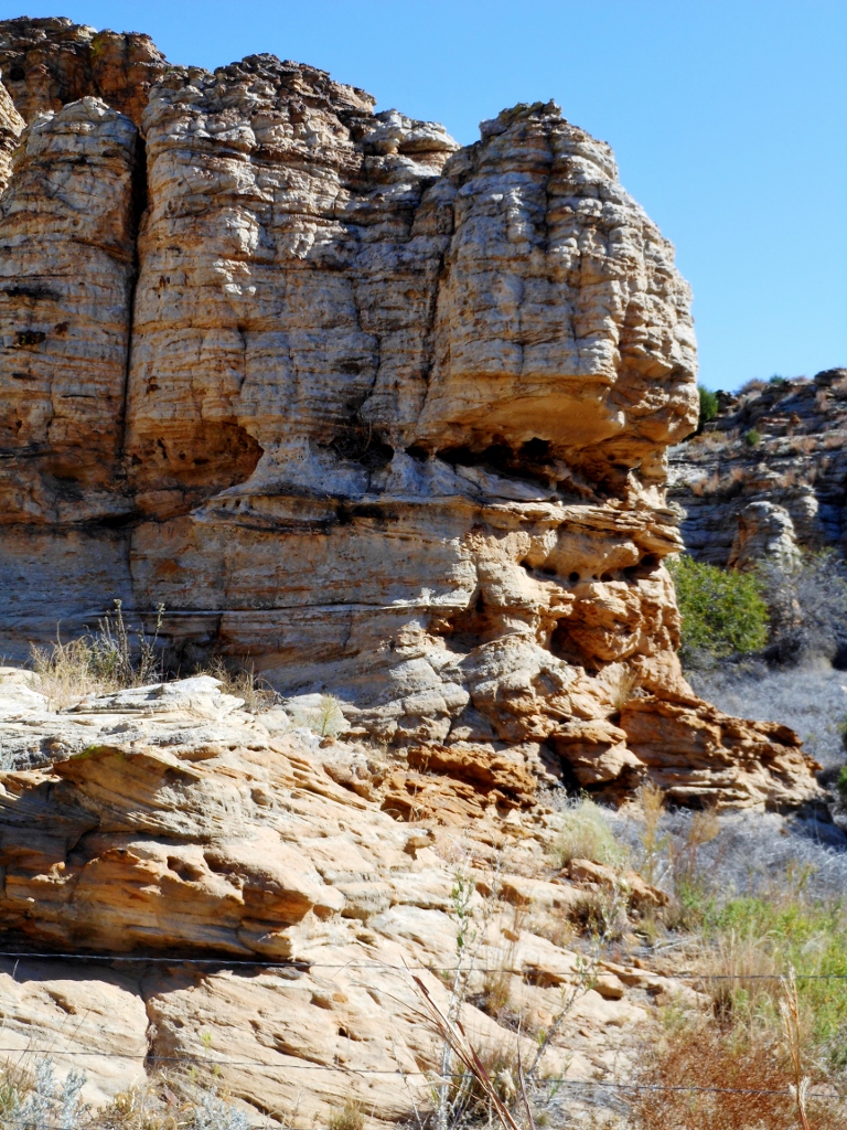
            Tucked back in these areas are springs, trees and rocky overhangs, where the Indians could have shelter and carve in the rocks.  One such place is Picture Canyon, about 12 miles due west of Campo and a few miles south.  Here one drives out of the flat lands into scrub forest and rocky gulches. 

            The rock walls made great easels for early many.  The Indians left their mark with Pictographs and petroglyphs.  They were not alone the early European explorers left their mark also.  There are some petroglyphs that archeologists speculate may have been Viking/Celtic in origin.  Which raises the questions, were the Northern Europeans, exploring in Western North America. 

            No matter what, it is still a fun place to drive back into and watch the land change.  Looking at the cliffs, there are the occasional overhangs/caves that show signs of soot on the rocks.  Here in late summer the Indian could sit here and work his buffalo meat into pemmican.  For here in the canyons are a variety of fruits, Choke Cherry, Hackberry and others. 
            There are also the remains of cabins that were built, late 1800’s.  It was a good area to graze cattle for summer pasture and a cabin for the trail rider. 

            It is an area to delve back more than a few thousand years.  The Folsom Point man roamed the area, before the present day plains Indians showed up.  The Comanche Indians are the contemporary residents of the area, living, hunting, working and playing in the canyons.  

Thursday, November 24, 2016

Following The Rails

Gilpin, Colorado
            Following the railroads, reveals lots of old communities that are no more.  Depending on the RR, spacing would 6-20 miles between stops.  The old steamers would need water and servicing and this is what lots of the stops were for.  They also were places to station the section crews that maintained the rails.  Here one could find section houses, a depot of sorts and if enough people were there an enterprising gentlemen would open a store.  Soon it would become a town, well maybe.  With the changes in railroad equipment, section assignments would change and small stops would become vacant as the workers were assigned to other districts.  What had been a place at one time, became a ghost place. Since lots of them did not become towns and have a Post Office, they do not show up on lots of maps.
Partial map showing some of the railroad spots. 

            I collect some railroad memorabilia and one of those treasures is time tables.  The RR tables would list the routes of trains and the control points.  These places would have a siding, maintenance crews and some buildings.  When I go hunting ghost communities I carry a few of these time tables to help me find some of the lost villages.  What’s interesting is if a town grew up, not associated with the RR, it does not show up.  So I carry some old maps and do lots of cross checking with the different places I’m looking for.  Sometimes these places pop up on digital, usually not.  Then other places pop on digital that shows on no other places.  It becomes a challenge to coordinate all the different little bits of info. 
            Gilpin is one of those little burgs that used to be that shows up most places.  There are a few things in the area but nothing to indicate a town had been there.  A rancher has built a corral nearby and across the road is a comm. Tower.  The railroad has some signal lights on the ROW for traffic control, which would be the only indicator that the railroad had anything here. 
There were times when the RR would have stock pens and load livestock on the train.

            The trains make a long climb out of the Arkansas Valley and Gilpin would have been the first stop on the ridge top.  Here the train would have gotten orders on how far to proceed and if there were any MOW crews on the tracks.  There would been a water tank and a depot of some type.  Sometimes the depot was an old boxcar sitting beside the rails.  Very seldom do I find reminders of those days.  Usually it is chunks of concrete marking where the various buildings had been.  As I go from here to there, I block out some time to travel along some of these out of the way routes, looking to see what I can see.  Sometimes I completely miss them and make U-turns, if I have not driven to far past them.  Or I put them in the hopper to chase down on another trip.

            Gilpin is on the edge of the desert and poor soil.  Not much grows on the limestone soil and there is very little rainfall.  Climbing up the ridge, the land changes to varied mesas, canyons and scrub forest.  A few cattle roam the sparse grassland and the occasional pick up rumbles down the road.  Otherwise it is pretty empty land as I muter down the road to the next stop.  


Friday, November 18, 2016

Southeastern Colorado

Edler, Colorado


The old map lists lots of old towns from the late 1800’s to about 1920’s.  There are wagon roads, cattle trails, stage routes and pioneer trails listed on it.  I pack it up with an idea of places I will go looking for.  The trails and roads are hardest to find, those usually involve a lucky per chance.  The little towns and stops are a bit easier in that the map is overlaid on fairly modern road map.  So off I go in search of ……… camera in tow plus other things. 
The Edler well, appears to still be in operation.


Many of the little towns are no more then a farm or ranch house where the Post Office had been located.  The remains of these places are usually a stand of trees and some concrete footers where the buildings once stood.  So when I went searching for Edler, I only expected to find an old house… maybe.  Instead I found the remains of a small village. 

There was a school house, church, some old buildings, water tank and nearby a local farmer had his operation.  I have no idea what the population had been but I would guess it had been around 100 people had lived here.  The Post Office was in operation until 1948 and the school probably lasted longer. 

Edler is in the dust bowl and the dust still blows at times in the area yet there are few who are tenacious and hang on.  Early 1850’s, there was another drought that pushed many more farmers off the land.  The area around Edler reflects that, for it is miles in between neighbors. 

This area of Southeastern Colorado is loaded with little burgs that used to be.  There are canyons with small streams nearby, scrub forests dot the ridges, a sight that does not fit the flat land conception of eastern Colorado.  To the south is an old copper mine, to the northeast was some gold mining.  Edler sits on the flat lands of farmland that is great land to farm when there is moisture. 

It is a land of surprising contrasts that I want to go back to and explore some more of the little villages that are no more.  

Friday, November 4, 2016

At Pavement's End

Toonerville, Colorado
Down there, Down where the backstop ends, is the remains of the village of Toonerville.  Most of the buildings are now rubble piles, the church at the north end still stands, abandoned and neglected.  It does not fit the typical stereotype of Colorado’s eastern flatlands.  Here it is mesas, canyons and scrub forest.  With the rocky cliffs, many of the building used the native hewn stone for their structures. 


Toonerville, began life as Red Rock but changed the town’s name after a cartoon of the 30’s, an animated streetcar named Toonerville.  They had a mock government that made non decisions of cartoon proportions.  It was a little village that survived on ranching and the nearby railroad. 


As railroad operations changed and the land dried out, many of the area jobs were lost and the people had to move on to find work in other places.  Down the road that goes through Toonerville, there is still a ranch house in operations at the end of the road.  Otherwise the area is pretty empty, one can drive for miles and maybe see on vehicle and possibly a ranch house. 


The land is not suitable for farming and it takes lots of land to graze a cow on.  Yet in the early 1899’s, Texas ranchers would drive their herds north into this area for summer pasture. The cattle roamed the land on free range and when the Fall round up came, many of the bovines were missed and spent the winters in a few sheltered canyons. 


When one pauses in the area, there are the few cattle roaming across the dry land searching for the sparse vegetation to munch on.  Rocky cliffs rise up on the horizon, boulder strewn bases, dotted with scrub juniper and occasional pinon.  Tree groves mark where the springs are or where the small creek flows.  It is a varied land of dry dusty twisters, marked with lush streams crossing the bottoms.  


Back in the trees is the little village.