Friday, December 30, 2016

Ark Valley RR .... Cornelia, CO.

Cornelia Colorado
            A wide spot along the rails and a huge warehouse is the extent of the little village of Cornelia. 
            When sugar beets dominated farming in the Arkansas Valley, the farmers built a railroad on the north side the river to serve the sugar beet farmers.  The east end of the rails were Holly Colorado and the west end was at Swink. 
            As the railroad prospered, other businesses were served and small towns popped next to the rails.  Most were not much more then a store and the rail terminal.  A few grew into little town with all the amenities of a prosperous country town. 


            Cornelia was one of the stops along the rails and like the sugar towns is faded into memory banks in the 60’s when federal sugar tariffs changed.  One of the little towns on the rail line was Hasty, the gateway to the John martin reservoir and Hasty Lake.  Here one can see the old rail bed next to the highway.  To the north along county roads there are other little burgs that have reminders of other days. 

            Cornelia is to the west and is on one of those county roads going to over there.  There is a huge warehouse still standing and a processing shed and a couple of homes.  It appears a farmer now operates, the old community remains.

Saturday, December 10, 2016

Ruxton, Colorado

Railroad Town

            Ruxton, Colorado was a small town built for railroad service.  Here there would have been maintenance of way crews and equipment, A depot of some type and few homes for the workers to live in.  The local train would stop here, dropping off supplies and people and picking up.  It was a wide spot out on the mesas of eastern Colorado. 

            Ruxton is located in one of Colorado’s more unique landscapes.  It is a dry land of cacti, mesas, gullies and canyons.  Scrub trees dot the land and along the springs and small creeks, there are groves of trees.  There are small oasis’s that are scattered across the empty land.  Cattle roam over the land and the occasional ranch house next to a spring. 
            Cattle shipping would have been handled by the railroad or sheep.  Early 1900’s, lots of sheep roamed the land but the land could not sustain the sheep.  Today it is mostly cattle roaming the land in search of sparse tufts of grass. 

            Along the dusty road there are old railroad cars, marking where corrals and pens are.  Here the rancher could drive his cattle in for shipment on the rails.
            There is the old stone house, now is state of falling apart.  Yet years ago it would have been a family’s dream home.  The first room was built, with door and window.  Later years, rooms were added on to the house, probably as the family grew.  The little stone house is the only sign there had been a village here. 


            The trains still roar by and MOW crews still work on the rails.  It is a vast land that has a song of silence, one can listen, for those that pause.  It is broken by the occasional pick up or train.  The grasses sway with the few trees as an easy breeze whispers through.  Clouds roll across the horizon keeping their moisture.  In silence, Ruxton sits.  

Sunday, December 4, 2016

Broom Factory

Broomcorn
            Pritchett, situated in the far southeastern corner of Colorado was at one time considered the capitol of broomcorn.  There was a factory there to manufacture brooms for shipment across the corner.  Broomcorn became an important cash product for the farmers.  The flat land was excellent production ground for growing crops and the farmers grew and grew. 

            Drive through Pritchett today and one would not even consider its importance to the region.  There are numerous empty building on Main Street and lots of vacant lots where there had been stores and shops.  There are a few businesses that operate, the grain elevator, a saloon and the Post Office, the school still teaches.   But life is much slower in the little country village that survived the “Dirty 30’s.”   
            The east/west highway sees the occasional traffic as it bends through town.  No longer are there brooms to be shipped around the country, today it is grain products.  Yet for the person that wanders through town, all kinds of past moments ripple through the imagination.  The workers that worked in the rural factory, going to an from work, pausing in the saloon, the few cars cruising main.  It would make a great Hollywood backdrop for a movie. 

            Neat old gas station on the corner, classic movie house, the saloon and a park on the corner to hang out in, the flappers from the 20’s or the Hot Rodders of the 50’s.  Any of these would fit right into the fabric of Pritchett.  Cruise down the street to where it turns, flip a U and cruise back to the other end of town.  Music rolling out of the saloon.  It is a western town on the eastern plains of Colorado. 
            Today the farming and ranching in the area keep the little town school open insuring the town has some life.  The tumbleweed can roll down the street not bothered but by the light breeze. 


The link takes one to the Baca County History, stories about broomcorn.


Saturday, November 26, 2016

The Comanche

Picture Canyon
            Situated in the SE corner of the state of Colorado is the Comanche Grasslands, owned by the Federal government.  The government bought up scores of acres and turned them is to grass in the attempts to slow down the dust bowl of the 30’s.  It also created recreational areas on the prairie, opening up wide variety public lands.  The nearby states also have huge sections of grasslands in the corners of their states. 

            The grasslands of New Mexico and Kansas encompass parts of the old Santa Fe Trail, following the Cimarron River, mostly dry.  There is the flat rolling land that is prone to blow and there is the surprise of the canyons and mesas in the area.  Just north of the Oklahoma border, in Colorado is a large area of land broken with canyons and rocky cliffs. 
            Tucked back in these areas are springs, trees and rocky overhangs, where the Indians could have shelter and carve in the rocks.  One such place is Picture Canyon, about 12 miles due west of Campo and a few miles south.  Here one drives out of the flat lands into scrub forest and rocky gulches. 

            The rock walls made great easels for early many.  The Indians left their mark with Pictographs and petroglyphs.  They were not alone the early European explorers left their mark also.  There are some petroglyphs that archeologists speculate may have been Viking/Celtic in origin.  Which raises the questions, were the Northern Europeans, exploring in Western North America. 

            No matter what, it is still a fun place to drive back into and watch the land change.  Looking at the cliffs, there are the occasional overhangs/caves that show signs of soot on the rocks.  Here in late summer the Indian could sit here and work his buffalo meat into pemmican.  For here in the canyons are a variety of fruits, Choke Cherry, Hackberry and others. 
            There are also the remains of cabins that were built, late 1800’s.  It was a good area to graze cattle for summer pasture and a cabin for the trail rider. 

            It is an area to delve back more than a few thousand years.  The Folsom Point man roamed the area, before the present day plains Indians showed up.  The Comanche Indians are the contemporary residents of the area, living, hunting, working and playing in the canyons.  

Thursday, November 24, 2016

Following The Rails

Gilpin, Colorado
            Following the railroads, reveals lots of old communities that are no more.  Depending on the RR, spacing would 6-20 miles between stops.  The old steamers would need water and servicing and this is what lots of the stops were for.  They also were places to station the section crews that maintained the rails.  Here one could find section houses, a depot of sorts and if enough people were there an enterprising gentlemen would open a store.  Soon it would become a town, well maybe.  With the changes in railroad equipment, section assignments would change and small stops would become vacant as the workers were assigned to other districts.  What had been a place at one time, became a ghost place. Since lots of them did not become towns and have a Post Office, they do not show up on lots of maps.
Partial map showing some of the railroad spots. 

            I collect some railroad memorabilia and one of those treasures is time tables.  The RR tables would list the routes of trains and the control points.  These places would have a siding, maintenance crews and some buildings.  When I go hunting ghost communities I carry a few of these time tables to help me find some of the lost villages.  What’s interesting is if a town grew up, not associated with the RR, it does not show up.  So I carry some old maps and do lots of cross checking with the different places I’m looking for.  Sometimes these places pop up on digital, usually not.  Then other places pop on digital that shows on no other places.  It becomes a challenge to coordinate all the different little bits of info. 
            Gilpin is one of those little burgs that used to be that shows up most places.  There are a few things in the area but nothing to indicate a town had been there.  A rancher has built a corral nearby and across the road is a comm. Tower.  The railroad has some signal lights on the ROW for traffic control, which would be the only indicator that the railroad had anything here. 
There were times when the RR would have stock pens and load livestock on the train.

            The trains make a long climb out of the Arkansas Valley and Gilpin would have been the first stop on the ridge top.  Here the train would have gotten orders on how far to proceed and if there were any MOW crews on the tracks.  There would been a water tank and a depot of some type.  Sometimes the depot was an old boxcar sitting beside the rails.  Very seldom do I find reminders of those days.  Usually it is chunks of concrete marking where the various buildings had been.  As I go from here to there, I block out some time to travel along some of these out of the way routes, looking to see what I can see.  Sometimes I completely miss them and make U-turns, if I have not driven to far past them.  Or I put them in the hopper to chase down on another trip.

            Gilpin is on the edge of the desert and poor soil.  Not much grows on the limestone soil and there is very little rainfall.  Climbing up the ridge, the land changes to varied mesas, canyons and scrub forest.  A few cattle roam the sparse grassland and the occasional pick up rumbles down the road.  Otherwise it is pretty empty land as I muter down the road to the next stop.  


Friday, November 18, 2016

Southeastern Colorado

Edler, Colorado


The old map lists lots of old towns from the late 1800’s to about 1920’s.  There are wagon roads, cattle trails, stage routes and pioneer trails listed on it.  I pack it up with an idea of places I will go looking for.  The trails and roads are hardest to find, those usually involve a lucky per chance.  The little towns and stops are a bit easier in that the map is overlaid on fairly modern road map.  So off I go in search of ……… camera in tow plus other things. 
The Edler well, appears to still be in operation.


Many of the little towns are no more then a farm or ranch house where the Post Office had been located.  The remains of these places are usually a stand of trees and some concrete footers where the buildings once stood.  So when I went searching for Edler, I only expected to find an old house… maybe.  Instead I found the remains of a small village. 

There was a school house, church, some old buildings, water tank and nearby a local farmer had his operation.  I have no idea what the population had been but I would guess it had been around 100 people had lived here.  The Post Office was in operation until 1948 and the school probably lasted longer. 

Edler is in the dust bowl and the dust still blows at times in the area yet there are few who are tenacious and hang on.  Early 1850’s, there was another drought that pushed many more farmers off the land.  The area around Edler reflects that, for it is miles in between neighbors. 

This area of Southeastern Colorado is loaded with little burgs that used to be.  There are canyons with small streams nearby, scrub forests dot the ridges, a sight that does not fit the flat land conception of eastern Colorado.  To the south is an old copper mine, to the northeast was some gold mining.  Edler sits on the flat lands of farmland that is great land to farm when there is moisture. 

It is a land of surprising contrasts that I want to go back to and explore some more of the little villages that are no more.  

Friday, November 4, 2016

At Pavement's End

Toonerville, Colorado
Down there, Down where the backstop ends, is the remains of the village of Toonerville.  Most of the buildings are now rubble piles, the church at the north end still stands, abandoned and neglected.  It does not fit the typical stereotype of Colorado’s eastern flatlands.  Here it is mesas, canyons and scrub forest.  With the rocky cliffs, many of the building used the native hewn stone for their structures. 


Toonerville, began life as Red Rock but changed the town’s name after a cartoon of the 30’s, an animated streetcar named Toonerville.  They had a mock government that made non decisions of cartoon proportions.  It was a little village that survived on ranching and the nearby railroad. 


As railroad operations changed and the land dried out, many of the area jobs were lost and the people had to move on to find work in other places.  Down the road that goes through Toonerville, there is still a ranch house in operations at the end of the road.  Otherwise the area is pretty empty, one can drive for miles and maybe see on vehicle and possibly a ranch house. 


The land is not suitable for farming and it takes lots of land to graze a cow on.  Yet in the early 1899’s, Texas ranchers would drive their herds north into this area for summer pasture. The cattle roamed the land on free range and when the Fall round up came, many of the bovines were missed and spent the winters in a few sheltered canyons. 


When one pauses in the area, there are the few cattle roaming across the dry land searching for the sparse vegetation to munch on.  Rocky cliffs rise up on the horizon, boulder strewn bases, dotted with scrub juniper and occasional pinon.  Tree groves mark where the springs are or where the small creek flows.  It is a varied land of dry dusty twisters, marked with lush streams crossing the bottoms.  


Back in the trees is the little village. 

Friday, October 21, 2016

Environmental Clutter .... Visual Pollution

600 Megawatt Power Plant


         Xcel Energy Company of Denver, Colorado, has proposed building a 600 Megawatt power plant across the Eastern Colorado Central Plains.  It would stretch from near Deertrail, Colorado, south across the Palmer Divide to Rush Creek, then Southeast along Rush Creek to almost Hasewell, Colorado.  The proposed electrical plant would cover 40,000 acres.  This wind powered electrical plant would involve 400 wind turbines at an estimated cost of over One Billion Dollars.  Xcel is expecting to receive 700 million dollars from the Federal Government to build the project or three fourths of the money to build would come from taxpayers. 
            For comparison, the Cherokee generating station north of Denver, produces 580 Megawatts of electricity and covers roughly 1000 acres.  The customers for Xcel are close by not requiring long distance transmission lines.  The Power Plant in Brush, Colorado has an output of 505 Megawatts, about 20% smaller.  It covers about 1000 acres which includes a cooling pond of 140 acres.  The Department of Wildlife uses this cooling pond to raise fish for stocking of fisheries around the state of Colorado.  The Valmont station, near Boulder, Colorado is situated along the banks of Boulder Creek, creating a very picturesque and scenic setting.  The plant is smaller, generating 227 Megawatts of electrical power.  Valmont Lake on the edge of the plant is for cooling, yet it supports a large variety of wildlife and fish. 
            Lots of this will change as the coal fired plants are being replaced Natural Gas fired power production generators.  Here are three plants that have a combined capacity of 1312 Megawatts of production and would cover about 3000 acres of ground and be of benefit to wildlife and have a recreational value to the people of Colorado.  So gas/coal fired plants produce 1 Megawatt of electricity per 2 acres of ground.  Whereas the Rush Creek wind powered plant will produce 1.5 Megawatts of electrify per 1000 acres. 
            The other thing is the power consumed transporting the watts across transmission lines.  The power plants located near the cities along Colorado Front Range, do not lose as much electricity transporting the watts to the consumer.  Whereas the Wind power plants on the Eastern Plains require long journeys to get the watts to the Front Range consumer.  Boulder, Colorado has passed a resolution wanting renewable/clean energy.  So much of the Rush Creek power would be earmarked for Boulder, a journey of 100 to 150 miles to get to Boulder.  Approximately 10% of the energy produced would not arrive in Boulder for it would be consumed in transporting the power to the Front Range.  One of the biggest problems with electricity is its transportation costs and how much is lost on moving and or converting the power grid. 
            One of the unexplored assumptions in wind generated electricity is that it is considered clean, but is it really clean energy.  Consider all the holes in the ground that have to be dug to produce the materials to build a wind turbine with tower.  How much iron ore has to be dug, and then refined into to iron pigs.  Lots of iron is imported because of local environmental regulations that stopped lots of steel mills from production.  Then there is all the energy need to process the iron into steel.  Then there are the mines to produce the ore to strengthen the steel.  The Copper pits need to get ore to produce copper wire and then the mines for the rare earth minerals used to regulate the turbines and electrical flow.  Next is all the petroleum products used on the production of all the raw materials.  Then the petroleum byproducts in the plastics for wrappings and insulation not to mention the lightweight carbon fiber used on coverings. 
            By the time all the labor, technology and money has been invested in a wind turbine, its expected life is but 15 years.  After the wind turbine dies, where does it go?  In some instances, the motionless windmill sits on the plains as a monument to ______________ .
            Another thing that does not have much discussion is the pay back for investment.  Generally something with a short life span, 15 years, a 1-3 year payback is sought.  From various comments, the payback of a wind turbine does not begin until after the tenth year, so only the last five years is it a net producer, a very poor return on investment. 
            With wind farms, various environmental impact reports have been dismissed.  Environmental Impact Reports were a tool used by environmental groups over the years to block, stop or eliminate projects they did not like.  Yet they have the illusion the wind power is clean and will not damage the environment, so the reports for large projects like this, they have put in the round file of 13 coffins. 
            It is a consensus that wind turbines are killers of big birds and many smaller species.  There is the story of the bird watchers out in the field studying birds.  They spotted a bird they thought was extinct; everybody got excited and stared taking pictures.  The bird took wing and flew away from the birders, right into the propeller of a wind turbine.  Feathers, blood and guts went flying across the field. 
            At one time the American Symbol, the Bald Eagle was considered an endangered bird species.  The eagle was given special protection laws, in the attempt to keep people from harming the endangered species.  That changed when the wind turbines blades were shown to be great killers of the American Bald Eagle.  The protection laws for the great birds were waived/ignored where there were wind farms.  Where the wind farms were located it was now okay to kill the great birds without consequences. 
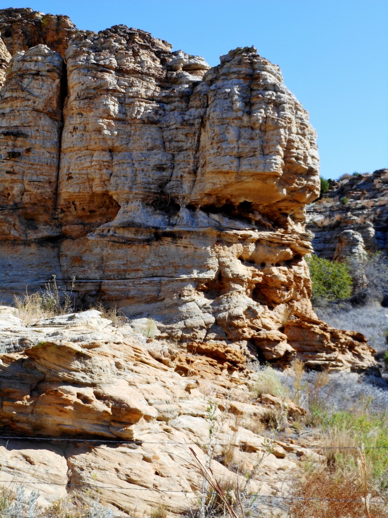
            The Rush Creek project stretches across some sensitive wildlife habitat, for a large variety of birds.  Besides being home to Bald Eagles, the massive Golden Eagle calls the area home.  There is a variety of other raptors in the area.  A tremendous assortment of hawks, falcons, owls, and waterfowl, live in the boundaries of the proposed project.  During migration, huge flocks of birds can be seen floating across the horizon.   Sand hill cranes, stop in the fields to glean the seeds left behind as do the geese and ducks.  The prairie ponds make nice habitat for the migrating birds.  Then there are the mid size birds, like the Mountain Plover, that some of the communities have bird festivals for.  All these birds would be under threat of mutilation by the spinning blades of the wind turbines.  And this killing would probably bring in more buzzards/vultures looking for a meal, resulting in more sliced up bird. 
            All the laws that have been passed in the past to protect wildlife become void when there is a wind farm. 
The Rush Creek Power Plant track will also cross some very sensitive areas of Archeology and environmental.  So many people along the Front Range see nothing in Eastern Colorado.  They see it as a devoid, barren land of no value.  Yet the power lines and wind mill sites will be built crossing ancient Indian villages, hunting grounds and burial sites.  It will also be crossing Creeks that are loaded with small springs that feed small ponds and creeks.  Activity around these areas can change the water flow of the springs and creeks and in worse case, destroy them.  Many an early pioneer built his home near these areas for a supply of water.  The rancher knew of them to provide water for his cattle and cattle trails followed along these creeks to where the springs were.  Water on the prairie is the life blood of the people that call it their home. 
Then there are the Indian sites along the land.  Tepee rings dot the land where the Indians used to live, fire rings are found nearby and a variety of ancient tools can be found in the area, arrowheads, scrapers, spear points, grinders and the occasional burial site.  Right over the top of these ancient sites the Power Plant will be built.  Again it appears that laws will be ignored, The Antiquity Act, to get the wind farm built. 
When the windfarm is built, there is road construction to access all the wind mills and carry the wiring that connects them into the power grid.  Then there are the tremendous holes in the ground that have to be dug and filled with concrete as an anchor base.  In a land where water is in short supply, water used in concrete puts lots of pressure on local water.  When the farm is completed, land has been tied up that is no longer productive land to the farmer or rancher.  When the life of the wind turbines expire what happens to them.   In instances of older wind generators wearing out and no longer useful, the operators have abandoned them and the windmills sit as a monument to something.  All the concrete anchor pads, which are equal to a 5-6 story building in size, are there in the ground. 
For when a farmer or rancher loses productive land, they lose a part of their income.  Dirt can not be rolled out on the Sixteenth Mall and then graze cattle.  Yet the pundits say that lost income is replaced by the rental income of the windmill.  Is the trading of tax dollars a replacement for lost income?  A reduced Ag income means the taxes paid by the Ag industry have been lost.  So when land is taken out of production, taxes are also lost.  Then when the windmills are abandoned, what does it take to restore the land to productivity?  Will the operators be forced to reclaim the land like the coal miners are forced?
The economics of this project is also questionable.  The Federal government will give Xcel Energy 700 million dollars to build the power plant.  That means that every citizen in the United States will give Xcel Energy two dollars out of their pocket.  In return what will these coerced citizens get from Xcel Energy?  The power generated from this farm will only go to a small portion of people on the Front Range.  The expensive impact of the project will reach into everybody’s pocket book.
Wind generated electricity is more expensive than the other methods, coal, nuclear and gas.  So on the backside a wind powered electrical plant will take more money out the pocket of people.  Electricity is one of the keystones that drives the economy.   It powers the motors in the production lines of the factories, the machines for tooling, the electronic machines of communication and the illumination of business buildings.  Without electrify, we would still be using candles to light the way. 
Wind generated electricity is roughly 25% more expensive then the conventional means of producing it.  That means, durable goods production pricing will go up, communication costs will go up, the cost of operating an office will go up, stores will have to pay more on their energy bill and across the board the price of everything increases.  With all these price increases, does the environment improve?  There has not been a consensus answer to that.
The economics of wind generated power raises so many questions and creates rubs that make sparks fly.  With the government subsidy, the price of wind generated power is more expensive then coal, nuclear or gas.  There are the maintenance expenses of the towers.  The land holders get lease payments plus there are the access roads to the turbines to gain access for repairs.  Again it is government subsidies that support these expenses.  After the life of the wind turbine expires, what happens to them?   In locations, the wind farm was left standing.  Silent giant windmills on the horizon, a monument to something. 
The land holder that leases some of his land to the operator likes it because they feel they are receiving increased revenue.  With government subsidies, it amounts to sending a 10 dollar bill to Washington DC and getting 50 cents back for their lease payment.  Every taxpayer in the county sends a couple of pennies to the land owner and what do they get back…… ?  I get an increase in my electric bill because the supplier raised their rate.  Of of the rate increase of a quarter, 20 cents go to the distributor and supplier and a nickel goes to the leaseholder of the wind turbine.  Again what does the land owner return to me for giving him a nickel? 
When a person looks at government subsidies, it can be seen that it creates lots of animosities for subsides favor a few that the many have to pay for and get nothing in return.  Yet it is something the government has been doing for decades and it has resulted in some scandalous deals over the years. 
So when a person looks at the Rush Creek wind farm, who benefits, where do the benefits go?  Who is damaged, why are they damaged?  Is there an upside to the project?  How much damage will there be in the construction of the project. 
One of the cleanest power plants for electricity is nuclear.  Because of the Atomic bomb, there has been lots of fear and scare tactics used against nuclear power plants.  Duke Energy, has an interest in some of the wind turbines around Burlington, Colorado.  Duke Energy is one of the biggest utility companies in the SE US, producing electricity for the Carolinas, Georgia, parts of Florida and surrounding areas.  They also operate Nuclear power plants, producing over 3000 Megawatts on plant sites of about 3000 acres, a ratio of one Megawatt per acre.  Compared to 1.5 Megawatts per 1000 acres on a wind farm. 
Even Xcel Energies largest power plant at Pueblo produces Megawatts at a good ratio of Fourteenhunded Megawatts on roughly 1400 acres of land.  On their web page, Xcel states they have 99% reduction of pollutants.  Comanche is a coal fired power plant and a 99% reduction is excellent.  The maintenance costs on a plant like Comanche are nominal compared to the expenses of repairing wind turbines. 
Nuclear far out shines the other methods of producing electricity on a cost benefit ratio.  The waste byproduct has become neutral over the years.  The nuclear waste dumps around the country are closely monitored and in the older storage sites, radiation has dropped to the levels as background radiation we receive daily. If a person wants renewable energy, nuclear would fit the bill.
Today, the use of natural gas is leading the way for electric production.  Listening to the people that work in the gas fields, many are saying that the gas is almost replaced as fast as it is extracted from the ground, making it a renewable fuel source.  In the ever expanding world of technology, wind generated electricity is falling way behind in delivering a reliable and affordable product. 
Wind turbines, tie up vast amounts of land, wasting numerous acres but most of all it is not reliable.  For the wind does not blow 24 7 365 days on the Prairie.  And when the wind does set down, nothing is produced by the windmills, they silently sit there being non productive.  Then when the wind does decide to roar, it is to strong of wind for the windmill and it has to be shut down, again being non productive. 

In today’s market, the natural gas fired power plants are the best value and gas is a renewable energy source that is virtually non pollutant.  

Sunday, October 2, 2016

Pond Creek

Stage Station
            During the Indian wars of the 1860’s, the stage lines were favorite targets of the Indians because they were small and few defenders.  They would attack the stage stations and drive the mules off and burn it down.  For this reason very few stage stops exist today.  There were two types of stations, there was the relay station and the home station.  The relay station was where the mules would be changed on the coach and on down the pike the stage would roll.  The home station was manned by a husband and wife and here the passengers on the coach could get a meal during the journey.  The home station would also house the relief drivers.
            With numerous Indian attacks, these stage stops developed some elaborate defensive strategies.  Home stations were built over cellars with trap doors where people could hide from the Indians.  Tunnels were also built from the house out to a little fort made of mud blocks and gun slots.  It would have a water barrel and with a repeating rifle the station master could defend against the Indians.  The mule pens were made of adobe blocks and wood, when possible a dug out in a hillside, called mule cellars.  If there were rocks available the station built the corrals of stone work and the hut.  With all these measures, the Indians would still launch attacks against the stage stations. 
            The Pond Creek Stage Stop has been preserved at the Ft Wallace, Kansas museum.  Pond Creek was a home station.  Here the stages stopped for meals and a brief respite of the journey.  The trap door to the cellar is still there as are the upstairs living quarters.  The kitchen and eating area are on the main floor.  The mule pens were left behind when the building was moved a short distance from its original site.

            1865 the Butterfield Overland Dispatch began operating a stage line to the Rocky Mountain gold fields. Near present day Wallace Kansas, they set up their home station.  A short distance away, the Army had established Fort Wallace.  This combination set up numerous conflicts between the Indians and the new comers.  Yet through all the battles the Pond Creek station survived.  The railroad showed up a year later and the BOD ceased operations but another operator kept the stages rolling and the station stayed busy transporting travelers from the rails on westward. 
            A writer from Harper’s Weekly took a stage ride across the prairie to the gold fields.  Not all of the troubles on the ride were from Indians.  Axels break on the coaches, or the harness breaks and the coach crashes into the ditch giving the riders a good tumble as the coach rolls over.  The dust rolled into the coach, turning everything a dusty brown.  The scorching heat of summer made for a miserable ride in the dust cloud.  Then there was the food, most of it was dried or salted for preservation.  Fresh meat was almost nonexistent and the sanitary conditions of some of the stops were questionable.  To get sick during the ride, well that was close to hopeless.  There are small unmarked graves along the roads of people that perished. 

            Mark Twain wrote an interesting story of Samuel Clemens stage ride to California on the overland route.  How they would try to arrange the mail pouches on the floor to sleep during the bouncy trip at night.  

Sunday, August 28, 2016

Norton

Norton Colorado
            Norton is like many of the little Post Offices that served the early settlers on the Colorado High Plains.  It was located in a ranch house and probably took its mane from the rancher.  Small communities would grow up in the area and sometimes retain the name. 
            Today the land is pretty empty, a few trees and sheds mark where homes had once been.  Here at Norton, there was a small cemetery, which is still used.  When I pulled off the road to take some pictures, a car pulled up and stopped.  A youngster walked up and said hi, I returned his greetings.  He said I could walk out there it was okay, I replied no thanks for I did not have my boots on for tromping in the weeds.  So I took my pictures and listened to him chatter away. 

            Pointing towards the back of the grave yard, he said that is my brother’s best friend buried back there, the cross made of horseshoes.  Looking quizzical, I asked him, what happened, expecting him to relate an accident of some type.  Instead he said it was something wrong with his heart, my brother’s friend was 13 when he died.  That was a loop I wasn’t expecting.  We talked a bit longer about the country side and then he went on down the road and I went about taking more pictures of the area. 
            Norton is located along the Palmer Divide area in Eastern Colorado, elevation 6500-7000 feet.  The winters can be pretty cold and harsh and the spring storms pretty nasty, hail falling like snow.  At this elevation there is not a long growing season for farming, so it is ranching in the area.  There are thick woods that line vast rolling meadows, making for great grazing for the bovines. 


            Tucked back in one of the meadows is a ranch house that probably housed the Norton Post Office.  I found the cemetery first sand it was not until I did some research that found out there had been a Post Office nearby.  

Friday, August 19, 2016

Republican River Road

Hale Colorado


            Like so many little burgs off the main highway, the community of Hale has disappeared into the dim reaches of memory.  Situated on the Republican River in Eastern Colorado, almost to the Kansas border, Hale had been a busy little place back in the late 1800’s.  The Republican River was a busy route to the Colorado gold fields in late 1800’s.  Freighters used this route for a number of years hauling to the mountains, Wagon trains of 100 wagons or so were quiet common.  For brief time a stage line operated through the area in 1859-60.  This is the stage route Horace Greeley rode to Colorado, of “Go West young man, Go West.” 
            The French had been in this area since the 1600’s trapping and exploring, they had established outposts along the river.  The Spanish traveled through the area also, looking to see what the French were up to.  It was an area of intrigue between the European rivals until the French sold it to the United States in 1802, The Louisiana Purchase.  This brought more explorers and curious people to the New West.  Zebulon Pike traveled the area in 1812, exploring and charting the newly purchased land of the United States.  At the time the early Europeans had gotten along with the native Indian tribes, using some Indians as their guides and trading with them.  The history of the French and Spanish in the area is pretty slim and a lots has to do with the interest lying in US history, not other countries. 
            So when gold was discovered in the Rocky Mountains, lots of the trails West had been laid out and mapped.  With large wagon trains rolling through, small trading posts were built by the road and a few settlers settled in.  The bottom land was rich for crops and grazing cattle.  Dotted along the Republican River from the Kansas border to its headwaters were numerous communities, mostly no more then a dozen souls living there.  With the homesteaders, the area became a bit more civilized and Post Offices came into being along the river. 
            The Hale Post Office was established in 1887 until 1945 when it was moved to another location a few miles away.  On the map from the early 1900’s, there are several other communities listed as being in the area.  One of these communities was Bonny, which lent its name to the new dam/reservoir being built in the 1950’s.  Bonny Dam gave some new life to the general store at Hale.  The store became a bait and tackle shop also selling items to the visitors of the lake and there were gas pumps. 

            Things change and Hale lost lots of its clientele as people changed the way they lived and then Bonny Lake was forced to be drained by the state of Kansas and that sealed the fate of the little country store. 
            What had been a nice flowing river had trickled into a tiny stream, the drought dried up lots of springs and tilling changed the run off.  There is still plenty of water but it is way down in the ground.  When Bonny was drained, lots of the close to surface water disappeared also.  The woods are thick offering forage and protection for the abundant wildlife in the area. 


            Hale still has its road sign, the old store still stands and there are a couple houses in the area.  For now it is the occasional rancher going through the area checking on the cattle.  The stagecoach that stopped nearby is no more.  The boaters and fisherman now go other places.  High overhead floats the Eagle, a reminder that some things do not change. 

Saturday, August 6, 2016

Fort Wallace

Fort Wallace Kansas

         Situated on the plains of western Kansas, The Army post is but a memory.  Built to protect travelers on the smoky Hill Trail from Indian attacks during the 1860’s.  Ft Wallace was one of many garrisons the Army constructed on the prairie.  The post cemetery is the only reminder that an Army garrison had been in the area.  Wallace Township cemetery is south of the military graveyard, and is probably the main reason the site did not become a collection of ruins. 

        When Ft Wallace was abandoned in the 1880’s, many of the soldiers that had been buried there were exhumed and reburied at Ft Leavenworth, Kansas, except for the soldiers that had died of cholera.  There were numerous civilians buried there also, they were given a wooden grave marker with a short eulogy about their death and there are some graves of scouts the Army used.  There is also a memorial for the soldiers that were killed by Indians during the Indian wars. 
        It is a rather somber yard to pause in and ponder.  One tends to forget the turmoil and hardship people had to endure back then.  Nearby is the Pond Creek state station and then the town of Wallace, an end of tracks railroad town.  The site of numerous bloody conflicts, among the Indians, the travelers, railroaders, gamblers and assorted wild times on the plains. 
        The state operates a museum at Wallace, Kansas and here at the Ft Wallace Museum, one can see many of the travails people faced when traveling the prairie during the 1860’s and 70’s.  The museum is on the site of the Pond Creek stage stop, just south of the railroad tracks and a couple of miles from Fort Wallace.  Here at the museum one can see the relationship between the people of the plains, their moments of tragedy, the joys of success and the celebrations of life. 
        The scouts the Army hired were not military, they were civilians, contracted to the military.  The scouts were the eyes and ears of the Army.  They knew the terrain, where the water was and had dealt with the Indians in the past.  Many had been Mountain Men, trappers and had made numerous trips across the plains. 
        One of the more famous scouts was Kit Carson, who had been chief scout for Colonel John Fremont, when he made his trips across the west.  The Pathfinder had taken various routs across Kansas to the Rocky Mountains, with trapper Kit Carson as his scout and guide. 
        Two of the scouts still buried at the Ft Wallace cemetery did not have a long life.  They were involved in the Battle of Beecher Island, where they lost their lives.  Beecher Island was one of the unusual fights with the Indians.  A party of Indians surprised a group of soldiers and killed some of the troopers before being driven off.  But the soldiers were trapped in the Aricakree River bottom by the Indians. 
        After an extended siege, the Indians withdrew from Beecher Island, when Troops from Ft Wallace could be seen on the horizon riding to the rescue.  The soldiers had been able to hold off the Indians with their repeating rifles.  It was also during this battle that the Indians lost one of their most feared warriors, Roman Nose.  Roman Nose was a revered warrior among the Cheyenne Indians standing over 6’5”, a giant of a man. 

        The site of the Beecher Island Battle has some conflict as to the actual site.  There are some that say the government is wrong that the fight took place further to the west in a steeper ravine.  Then things like that make for interesting conversation.  One thing for certain, the troops were from Fort Wallace.  There were numerous other battles the troopers of Ft Wallace were involved in.

        In the 1880’s when the fort was abandoned, it sat empty for some time with a caretaker.  With settlers moving in and homesteading in the 1890’s, the building material at the old fort became prized.  The settlers would sneak into the fort at night and haul out loads of lumber and stone for their home.  When the caretaker did nothing and was in different, the settlers stared driving their wagons in during daylight and scavenging what they wanted.  Today parts and pieces of Fort Wallace spread into the surrounding land.  

Saturday, July 30, 2016

Kansas Ghost

Wheeler, Kansas
            Located in the far Northwestern corner of Kansas, Wheeler is one of those little places that reaches out and grabs the curious like me to go have a look.  Turning off the highway I drove a short distance to where the town of Wheeler used to be and I was pleasantly rewarded.  Here is a collection of old building and relics in various states of neglected decay.  There appears to be about 5 homes still lived in and one of them is the old schoolhouse. 
            The grain elevator is still in operation, which probably keeps the town from completely disappearing.  There are some classic old elevators standing and a feed store.  Probably built around 1900 to 1910. Just enough aura to transfer the imaginative back to another era on the plains of hope and settlement. 


            One of the old store fronts is in pretty good shape, the other in a state of slow crumbling.  Yet in their day they served the townspeople and others in the area that traded there.  There are vacant lots where other stores stood and homes.  There is the main road into town and two little streets, each a block long.  The schoolhouse sits at the intersection of these last two streets. The school had a long veranda/porch added to the front and facing east probably makes nice cool shade during the heat of summer. 


            I went surfing for some info on the town.  Not much was found except that it was founded in the Township of Orlando.  The Post Office was there from 1888 to 1961 and other then that?????  Nothing was found on Orlando except that it was 35.9 square miles and the town of Wheeler was located in the township. 
            Townships were usually used for school boundaries, years ago, for taxation and also for census purposes.  Being unincorporated, Wheeler had zero population but the in 2010, Orlando had 63 souls to be counted for the census. 
            Like many little towns on the prairie, Wheeler had its peak population in 1930, before the ‘Dirty 30’s” began.  The dust storms chased many early settlers out of the country, off to, hopefully, greener pastures.  Few people hung on and the ones that remain today have consolidated much land into their farms and ranches. 
            One of the other interesting things I noticed is the style of different states how they refer to their districts.  Many use county, rather then town and now a township.  Wheeler quite often was referred to as Cheyenne county place in Orlando township. 

            The railroad tracks are still there but it looks like the rails have not seen a train is a few years.  The highway was realigned and the discontinuance of rail service has a major impact on the small prairie towns.